
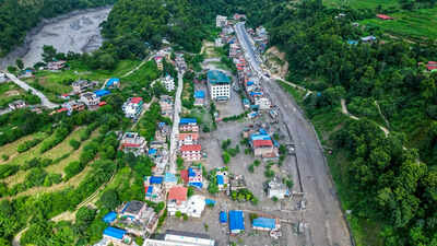
The deadly flash floods that tore through Nepal’s Himalayan border region on Wednesday may have been triggered by a massive chunk of glacier breaking away high in the mountains and crashing into a river valley below. An initial analysis by geologists and glaciologists cited by The New York Times suggests the event was an ice avalanche — a sudden collapse in which a huge mass of ice falls from a glacier, generating a powerful surge of water, ice and debris.Satellite imagery indicates that a section of glacier about 2,000 feet wide snapped off almost cleanly and fell from an altitude of around 17,000 feet, according to Daniel Shugar, a geologist at the University of Calgary who studied the images. The block dropped nearly 4,000 feet before reaching the valley floor, sending pulverised ice and water towards the Lhende Khola river and, ultimately, the Bhotekoshi River near the Nepal-China border.“It looks like a glacier in the area basically snapped off in a clean break, allowing it to fall just over a vertical kilometre to the valley bottom,” Shugar told the NYT. Describing the aftermath, he said: “The bottom looks like a bomb exploded — it’s just deposits from the broken-up glacier.”
How a huge mass of ice became a deadly flood
The scale and height of the collapse gave the falling ice enormous potential energy. Simon Cook, a glaciologist at the University of Dundee who also analysed the satellite imagery, said the impact could have pulverised the ice into a fast-moving mixture of water and debris.“This is a big chunk of ice that is stored at high elevation in the mountain, with a huge amount of potential energy,” Cook said, according to the NYT. “That ice just gets pulverized into water.”The flow then moved northwest through the valley towards the Lhende Khola and Bhotekoshi rivers, producing the sudden surge that swept through settlements, roads, bridges and hydropower infrastructure. Officials have warned that another flood remains possible because a blockage is still lodged upstream on the Lhende Khola.The exact sequence of events is not yet certain. A magnitude 4.4 earthquake was recorded in the region early Wednesday, while climate and disaster experts have also pointed to the possibility of an ice-rock avalanche. Scientists caution that it is too early to establish whether an earthquake played a role or to determine a single cause of the disaster.
A warning from a rapidly warming Himalaya
The disaster struck an area that has suffered a similar event within the past 14 months. Climate experts at the International Centre for Integrated Mountain Development said the Lhende Khola had flooded twice during that period, with last year’s flash flood linked to an overflowing glacial lake in Tibet.Saswata Sanyal, a disaster risk reduction specialist, said the latest flooding was triggered by an ice-rock avalanche from a glacier on the Nepal side that blocked the river before releasing a sudden surge downstream. He stressed the importance of early-warning systems in “a warming Himalaya”.The wider region is increasingly vulnerable to floods, landslides and glacier-related hazards as temperatures rise. Research cited in the reports indicates that glaciers across the Hindu Kush Himalaya are losing ice at an accelerating rate, with the pace of ice loss having increased sharply since 2000.The immediate disaster has left dozens dead and hundreds missing across Nepal and Tibet, while foreign tourists, workers and pilgrims were among those unaccounted for. Rescue teams have been deployed, but damaged roads, heavy sediment and unstable conditions have made access difficult.For the communities living along Nepal’s steep Himalayan valleys, Wednesday’s catastrophe offered a stark reminder of how quickly a seemingly remote change high in the mountains can turn into a deadly wall of water and debris downstream.

Leave a Reply